


$7,000.00
Parrot ANAFI USA Thermal Drone PF728210 by Red Wasp Drone
#Parrot #ParrotAnafi #ThermalDrone #thermalimagingdrone #infraredcameradrone #radiometricdrone
To balance the resolutions of the thermal image and visible image, and therefore benefit from information not visible in thermal, the displayed image is a fusion of the information from the two cameras.
Stabilized on three axes, the optical unit of ANAFI Thermal combines an infra-red sensor to the electro-optics, making it possible to identify temperatures between -10° and +400°. Thanks to the FLIR Lepton 3.5 module, it is possible to set the absolute temperature of each pixel.
Colourisation
In order to simplify the missions, to focus on its target and increase precision, temperature ranges can be defined to isolate the subjects of interest (e.g.: water leak, heat leak, etc.)
To refine the search for elements after the mission, the colour palettes of a video can be re-edited from the flight app, without having to download it.
Radiometry
Thanks to the FLIR Lepton 3.5 radiometric sensor, the maximum and minimum temperature of the observed scene can be determined. A specific point can be selected on the screen in order to find the exact temperature, making it possible to obtain precise and detailed data.
Assisted Flying
From the FreeFlight 6 app, different control modes can be configured. There is also the FlightPlan mode, allowing you to define a flight plan from a map, as well as specific points of interest and the orientation of the camera. The app automatically calculates the time that will be required to conduct the mission.
Thanks to the camera’s ability to orient itself 90° upwards, the underside of structures can be inspected and 360° panorama photos of the scene can be taken.
2D mapping
From the Pix4Dcapture app, the 2D Mapping function can be accessed. After collecting aerial shots of the observed area, the images are “stitched”, assembled, to obtain a 2D view of the terrain.
This function can be performed offline, without an internet connection: a nomad solution adapted to outdoor missions.
This tool is particularly useful for research missions, to identify points of interest on the map and send ANAFI Thermal for closure.
Compatible software
Pix4Dcapture
Schedule your flights to collect relevant images.
Pix4Dmapper
Visualize your environment in three dimensions.
Pix4Dreact
Use your data to derive terrain models.
Logo Flir Tools
FLIR Tools
Automatically carry out analyses of your thermal photos.
FreeFlight 6 app
Plan your missions and access all the features of ANAFI Thermal.

Parrot Anafi Thermal Drone, thermal imaging drone, infrared camera drone, radiometric drone, aerial mapping drone, inspection drone, industrial drone, thermal analysis drone, drone for research, drone for inspections,
#Parrot #ParrotAnafi #ThermalDrone #thermalimagingdrone #infraredcameradrone #radiometricdrone #aerialmappingdrone #inspectiondrone #industrialdrone #thermalanalysisdrone #droneforresearch #droneforinspections
Related products
-
Sale!

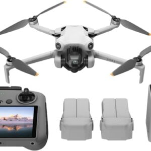
DJI Mini 4 Pro
Original price was: $1,200.00.$1,159.00Current price is: $1,159.00. BUY NOW -
Sale!
EXO Cinemaster 2
Original price was: $410.00.$379.00Current price is: $379.00. Buy Now -
Sale!
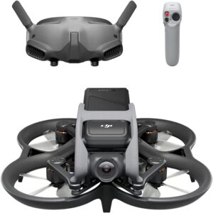
DJI Avata Pro-View Combo DJI Goggles 2
Original price was: $1,780.00.$1,388.00Current price is: $1,388.00. Add to Cart -
Sale!
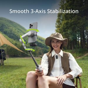
DJI Osmo Mobile 6
Original price was: $159.00.$149.00Current price is: $149.00. Buy Now