
Mapping with a Drone: Revolutionizing Data Collection by Red Wasp Drone
#Dronemapping #aerialmapping #photogrammetry #datacollection #highaccuracy
In recent years, the use of drones for mapping purposes has gained significant traction across various industries. Whether it’s land surveying, agriculture, construction, or environmental monitoring, drones have proved to be game changers in data collection and mapping. This article explores the fascinating world of mapping with drones and the numerous benefits it offers.
What is Drone Mapping?
Drone mapping, also known as aerial mapping or photogrammetry, refers to the process of capturing precise images of an area from an unmanned aerial vehicle (UAV) and then transforming those images into accurate maps or 3D models. By utilizing advanced GPS technology, high-resolution cameras, and sophisticated imaging software, drones can capture detailed imagery and data that were once only possible through traditional and costly survey methods.
Advantages of Drone Mapping
1. Time and Cost Efficiency
Drone mapping eliminates the need for manual surveying and significantly reduces the time and cost involved in data collection. Rather than mobilizing a large team and spending days or even weeks on the field, a single operator can pilot a drone and collect data efficiently. This not only reduces labor costs but also speeds up the entire mapping process.
2. High Accuracy and Detail
Drones equipped with high-resolution cameras can capture imagery with incredible detail. By utilizing overlapping images and advanced photogrammetry algorithms, drones can create highly accurate maps and 3D models. This level of precision enables professionals to make informed decisions based on reliable data, whether it’s for land surveying, infrastructure planning, or crop monitoring.
3. Wide Coverage and Accessibility
Drones have the ability to access areas that are difficult or dangerous for humans to reach. With their nimble flight capabilities, they can capture data from various angles, heights, and perspectives, providing a comprehensive view of the target area. This access to previously unreachable locations is particularly crucial for applications such as assessing disaster-stricken areas or surveying rugged terrains.
4. Real-Time Data Analysis
The integration of drones with advanced imaging software allows for real-time data analysis and on-site decision-making. With immediate access to visual information, professionals can identify potential issues or anomalies, assess the progress of a project, and make necessary adjustments without delay. This real-time feedback loop enhances efficiency and minimizes errors.
Applications of Drone Mapping
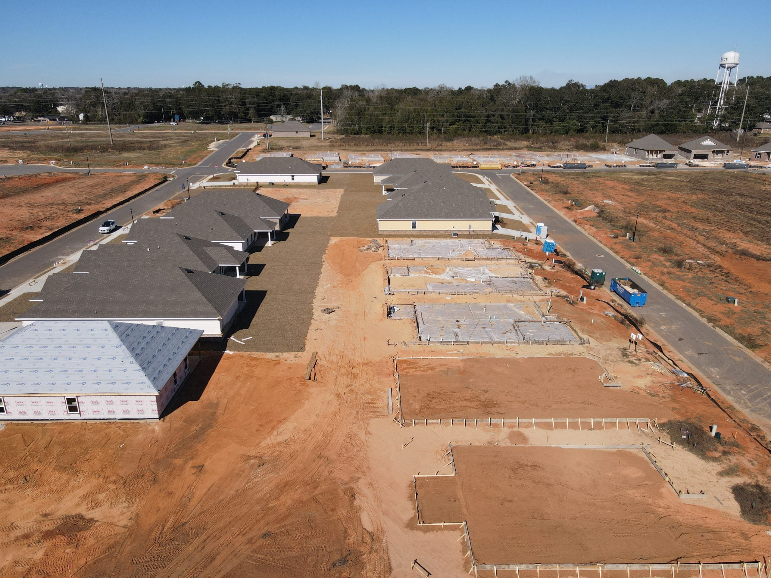
1. Construction and Infrastructure
Drone mapping plays a crucial role in the construction and infrastructure industries. From initial site surveys to monitoring ongoing projects, drones enable accurate mapping of topography, progress tracking, and quality control. This technology allows construction teams to identify potential issues early on, optimize resource allocation, and streamline the entire construction process.
2. Agriculture and Land Management
In agriculture, drones provide valuable insights for precision farming and land management. By collecting data on crop health, soil conditions, and irrigation patterns, farmers can optimize fertilizer usage, monitor disease outbreaks, and ensure efficient water management. Drone mapping empowers farmers to make data-driven decisions that enhance productivity, reduce costs, and promote sustainable practices.
3. Environmental Monitoring and Conservation
Drones have become indispensable tools for environmental monitoring and conservation efforts. With their ability to cover large areas quickly and efficiently, they can monitor wildlife populations, track deforestation, and assess the impact of natural disasters. Drone mapping enables researchers and conservationists to better understand ecosystems, implement conservation strategies, and protect our planet’s biodiversity.
Conclusion
Mapping with drones has revolutionized data collection across various industries, offering unprecedented accuracy, efficiency, and accessibility. The ability to capture high-resolution imagery, generate precise maps, and analyze data in real-time provides professionals with invaluable insights. As drone technology continues to advance, we can expect even more exciting applications and innovations in the field of mapping. Embracing this technology paves the way for improved decision-making, efficiency gains, and sustainable practices.

Drone mapping, aerial mapping, photogrammetry, data collection, high accuracy, cost efficiency, real-time analysis, construction, agriculture, environmental monitoring,
#Dronemapping #aerialmapping #photogrammetry #datacollection #highaccuracy #costefficiency #realtimeanalysis #construction #agriculture #environmental #monitoring
Comments are closed